Category:Frinton and Walton
Jump to navigation
Jump to search

civil parish in Essex, England | |||||
| Upload media | |||||
| Instance of | |||||
|---|---|---|---|---|---|
| Location | Tendring, Essex, East of England, England | ||||
| official website | |||||
 | |||||
Subcategories
This category has the following 5 subcategories, out of 5 total.
Media in category "Frinton and Walton"
The following 200 files are in this category, out of 638 total.
(previous page) (next page)-
 A corner of the course, Frinton Golf Club - geograph.org.uk - 6058711.jpg 1,024 × 768; 288 KB
-
 A Great Holland Pit - geograph.org.uk - 3053931.jpg 429 × 640; 117 KB
-
 A path which is not a path, Frinton sea front - geograph.org.uk - 5440890.jpg 1,600 × 1,200; 790 KB
-
 A Small Pit - geograph.org.uk - 3053950.jpg 429 × 640; 117 KB
-
 A Soken Stream - geograph.org.uk - 2379908.jpg 428 × 640; 80 KB
-
 A steep ol' climb - geograph.org.uk - 3458840.jpg 1,600 × 1,067; 827 KB
-
 A view of the grid - geograph.org.uk - 2148408.jpg 1,024 × 691; 103 KB
-
 Access to storage area by B1032 - geograph.org.uk - 5439738.jpg 1,600 × 1,067; 669 KB
-
 Across The Roofs - geograph.org.uk - 4025855.jpg 1,024 × 683; 110 KB
-
 Across Walton Channel to The Twizzle - geograph.org.uk - 4499526.jpg 1,600 × 1,064; 425 KB
-
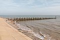
 Albion Breakwater, Walton-on-the-Naze - geograph.org.uk - 2314430.jpg 3,888 × 2,592; 1.44 MB
-
 Albion Breakwater, Walton-on-the-Naze - geograph.org.uk - 6066311.jpg 1,024 × 768; 189 KB
-
 All Numbered - geograph.org.uk - 4025832.jpg 1,024 × 683; 83 KB
-

-

-
 Art Deco style building, The Esplanade, Frinton - geograph.org.uk - 5842310.jpg 4,000 × 3,000; 4.8 MB
-
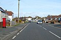
 Ashlyns Road, Frinton-on-Sea - geograph.org.uk - 4060747.jpg 1,536 × 1,152; 955 KB
-
 B1032 At Great Holland - geograph.org.uk - 3053959.jpg 640 × 429; 89 KB
-
 B1032 at Lodge Farm - geograph.org.uk - 402163.jpg 640 × 426; 122 KB
-
 B1033 Frinton Road - geograph.org.uk - 6055105.jpg 1,024 × 684; 213 KB
-
 B1033 Frinton Road - geograph.org.uk - 6055117.jpg 1,024 × 684; 330 KB
-
 B1033 Thorpe Road, Kirby Cross - geograph.org.uk - 6055020.jpg 1,024 × 684; 224 KB
-
 B1034 leaving Kirby-le-Soken - geograph.org.uk - 5369578.jpg 640 × 480; 61 KB
-
 B1034 towards Kirby-le-Soken - geograph.org.uk - 5369554.jpg 640 × 480; 71 KB
-
 B1336 Walton Road - geograph.org.uk - 6055208.jpg 1,024 × 684; 187 KB
-
 Backwater Plea - geograph.org.uk - 2379921.jpg 640 × 428; 65 KB
-
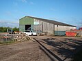 Barn off Little Clacton Road - geograph.org.uk - 5368824.jpg 640 × 480; 65 KB
-
 Base Of The Memorial - geograph.org.uk - 4025701.jpg 1,024 × 623; 205 KB
-
 Bat Boxes in Glebe Barn - geograph.org.uk - 3053863.jpg 429 × 640; 108 KB
-
 Beach and Beach Huts Walton on Naze - geograph.org.uk - 2262691.jpg 4,000 × 3,000; 2.92 MB
-
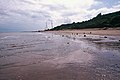
 Beach at The Naze - geograph.org.uk - 6076240.jpg 1,600 × 1,200; 602 KB
-
 Beach below East Terrace, Walton-on-the-Naze - geograph.org.uk - 6066097.jpg 1,024 × 768; 228 KB
-
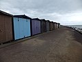
 Beach Hut Scene - geograph.org.uk - 6223799.jpg 800 × 570; 109 KB
-
 Beach Huts - geograph.org.uk - 4025166.jpg 1,024 × 683; 122 KB
-
 Beach Huts - geograph.org.uk - 4025819.jpg 1,024 × 683; 146 KB
-
 Beach Huts - geograph.org.uk - 4025825.jpg 1,024 × 683; 174 KB
-
 Beach Huts - geograph.org.uk - 4027896.jpg 1,024 × 683; 155 KB
-
 Beach Huts - geograph.org.uk - 4027902.jpg 1,024 × 683; 163 KB
-
 Beach huts at Frinton-on-Sea - geograph.org.uk - 4060719.jpg 1,536 × 1,152; 974 KB
-
 Beach huts on the seafront at Frinton-on-Sea - geograph.org.uk - 4060239.jpg 1,536 × 1,152; 899 KB
-
 Beach huts over the beach, south of Frinton - geograph.org.uk - 4060255.jpg 1,536 × 1,152; 842 KB
-
 Beach huts, Frinton - geograph.org.uk - 6059266.jpg 1,024 × 768; 227 KB
-
 Beach huts, Walton-on-the-Naze - geograph.org.uk - 6055331.jpg 1,024 × 768; 284 KB
-
-
 Beach View - geograph.org.uk - 6219312.jpg 800 × 600; 99 KB
-
 Beach, Frinton-on-Sea - geograph.org.uk - 5369095.jpg 640 × 480; 80 KB
-

-
 Beach, Walton on the Naze, Essex - geograph.org.uk - 4190739.jpg 1,238 × 825; 1,008 KB
-
 Beach, Walton on the Naze, Essex - geograph.org.uk - 4190781.jpg 1,238 × 825; 841 KB
-
 Beach, Walton-on-the-Naze - geograph.org.uk - 5369120.jpg 640 × 480; 49 KB
-
 Beach, Walton-on-the-Naze - geograph.org.uk - 6066321.jpg 1,024 × 768; 206 KB
-
 Beacon View - geograph.org.uk - 6220273.jpg 800 × 600; 60 KB
-
 Beacon, Walton on the Naze, Essex - geograph.org.uk - 4190700.jpg 1,238 × 928; 1.42 MB
-
 Beacon, Walton on the Naze, Essex - geograph.org.uk - 4190701.jpg 1,238 × 825; 864 KB
-
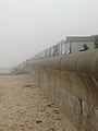
 Behind the sea wall at Sandy Point - geograph.org.uk - 6058948.jpg 1,024 × 768; 273 KB
-
 Blanchard Close at the junction of Frinton Road - geograph.org.uk - 5337462.jpg 2,304 × 1,728; 847 KB
-
 Blossom in Soken Wood - geograph.org.uk - 2379934.jpg 428 × 640; 48 KB
-

-
 Breakwater Scene - geograph.org.uk - 6220247.jpg 800 × 600; 95 KB
-
 Breakwater View - geograph.org.uk - 6219307.jpg 800 × 583; 83 KB
-
 Breakwaters, The Naze Beach - geograph.org.uk - 3588676.jpg 640 × 481; 285 KB
-
 Bridleway to Great Holland - geograph.org.uk - 6059207.jpg 1,024 × 768; 251 KB
-
 Building under conversion, The Street - geograph.org.uk - 3952455.jpg 750 × 562; 105 KB
-
 Bungalow on Frinton Road, Kirby Cross - geograph.org.uk - 5337578.jpg 2,256 × 1,664; 919 KB
-
 Bungalows on Frinton Road, Kirby Cross - geograph.org.uk - 5343182.jpg 2,260 × 1,668; 1.06 MB
-

-
 Buoy opposite end of beach huts, Frinton - geograph.org.uk - 6059228.jpg 1,024 × 684; 215 KB
-
 Bus shelter, Main Road, Great Holland - geograph.org.uk - 5439746.jpg 1,600 × 1,200; 676 KB
-

-
 Bus stop on Walton Road - geograph.org.uk - 5369099.jpg 640 × 480; 65 KB
-

-
 Bus waiting to start route 105 to Colchester - geograph.org.uk - 6066170.jpg 1,024 × 684; 172 KB
-
 Businesses on Thorpe Road, Kirby Cross - geograph.org.uk - 5337635.jpg 2,304 × 1,728; 837 KB
-
 Butcher's shop, Connaught Avenue, Frinton - geograph.org.uk - 4422427.jpg 4,578 × 3,634; 4.25 MB
-
 Cafe Walton on the Naze, Essex - geograph.org.uk - 4190710.jpg 1,238 × 929; 1.15 MB
-
 Cambridge Road, Frinton-on-Sea - geograph.org.uk - 1814242.jpg 4,000 × 3,000; 2.9 MB
-
 Car Park, Walton on the Naze, Essex - geograph.org.uk - 4188342.jpg 1,238 × 825; 839 KB
-
 Car Park, Walton on the Naze, Essex - geograph.org.uk - 4188344.jpg 1,238 × 825; 726 KB
-
 Carnaby House, The Esplanade, Frinton-on-Sea - geograph.org.uk - 1814267.jpg 4,000 × 3,000; 2.92 MB
-
 Carousel at Walton Pier - geograph.org.uk - 6224562.jpg 800 × 584; 159 KB
-
 Central Avenue, Pedlars Wood, Frinton-on-Sea - geograph.org.uk - 4058953.jpg 1,536 × 1,152; 1.03 MB
-
 Central Beach - geograph.org.uk - 2064094.jpg 480 × 640; 63 KB
-
 Central Beach, Walton-on-the-Naze - geograph.org.uk - 2750582.jpg 4,000 × 3,000; 3.77 MB
-
 Cherry blossom, Third Avenue - geograph.org.uk - 5853979.jpg 1,196 × 1,789; 390 KB
-

-

-
 Clacton Road (B1032) - geograph.org.uk - 5368842.jpg 640 × 480; 98 KB
-

-
 Cliff Erosion - geograph.org.uk - 4025042.jpg 1,024 × 683; 164 KB
-
 Cliff Parade, Walton-on-the-Naze - geograph.org.uk - 5369544.jpg 640 × 480; 48 KB
-
-
 Cliffs and beach, The Naze - geograph.org.uk - 1187852.jpg 640 × 457; 161 KB
-
 Cliffs under the Naze Tower, Walton - panoramio (2).jpg 3,936 × 2,664; 2.67 MB
-
 Cliffs under the Naze Tower, Walton - panoramio.jpg 4,055 × 2,849; 2.65 MB
-
 Cliffs Walton on the Naze, Essex - geograph.org.uk - 4190704.jpg 1,238 × 825; 1.14 MB
-
 Cliffs Walton on the Naze, Essex - geograph.org.uk - 4190705.jpg 1,238 × 825; 1.19 MB
-
 Clock Tower on Sea Front - geograph.org.uk - 1951601.jpg 640 × 480; 84 KB
-

-

-
 Coastal Erosion - geograph.org.uk - 5449841.jpg 640 × 480; 53 KB
-
 Coastal Erosion at Walton on Naze - geograph.org.uk - 2262984.jpg 4,000 × 3,000; 2.84 MB
-
 Coastal View - geograph.org.uk - 6224583.jpg 800 × 575; 88 KB
-
 Coastline - geograph.org.uk - 4025076.jpg 1,024 × 683; 125 KB
-
 Coles Lane, Walton-on-the-Naze - geograph.org.uk - 5369549.jpg 640 × 480; 77 KB
-
 Commemoration Stone, Frinton-on-Sea - geograph.org.uk - 4024799.jpg 3,072 × 2,304; 1.78 MB
-
 Connaught Avenue, Frinton - geograph.org.uk - 5842011.jpg 4,000 × 3,000; 4.91 MB
-
 Connaught Avenue, Frinton on Sea - geograph.org.uk - 6280371.jpg 5,472 × 3,648; 4.62 MB
-
 Connaught Mews, Frinton - geograph.org.uk - 5337310.jpg 2,266 × 1,676; 1.05 MB
-
 Connaught Road, Frinton - geograph.org.uk - 5337306.jpg 2,304 × 1,728; 818 KB
-
 Convenience store on High Street, Walton on the Naze - geograph.org.uk - 5390668.jpg 2,592 × 1,944; 1.22 MB
-
 Covered Promenade - geograph.org.uk - 6224558.jpg 800 × 600; 89 KB
-
 Crescent Gardens - geograph.org.uk - 6221980.jpg 800 × 600; 159 KB
-
 Crescent Gardens, Frinton - geograph.org.uk - 5842291.jpg 3,000 × 4,000; 3.95 MB
-
 Crescent Road, Walton-on-the-Naze - geograph.org.uk - 5875513.jpg 1,600 × 1,064; 340 KB
-
 Crop field near Lodge Farm - geograph.org.uk - 5368840.jpg 640 × 480; 104 KB
-
 Crop field south of the B1034 - geograph.org.uk - 5369550.jpg 640 × 480; 71 KB
-
 Crop field, Great Holland - geograph.org.uk - 5368828.jpg 640 × 480; 88 KB
-
 Crop field, Kirby-le-Soken - geograph.org.uk - 5369556.jpg 640 × 480; 66 KB
-
 Crossing View - geograph.org.uk - 6221771.jpg 800 × 600; 120 KB
-
 Detail of beach material, The Naze - geograph.org.uk - 1187883.jpg 640 × 457; 201 KB
-
 Disused water fountain, Walton-on-the-Naze - geograph.org.uk - 6066303.jpg 1,024 × 768; 223 KB
-
 Drinking fountain, Frinton-on-Sea - geograph.org.uk - 5440858.jpg 1,200 × 1,600; 750 KB
-
 Dutch barge moored at Walton ^ Frinton Yacht Club - geograph.org.uk - 2317793.jpg 3,000 × 4,000; 1.97 MB
-
 Eagles Farm - geograph.org.uk - 3588659.jpg 640 × 481; 338 KB
-
 Early Morning at Great Holland Pits - geograph.org.uk - 3053907.jpg 640 × 429; 86 KB
-
 East Terrace Beach - geograph.org.uk - 3406631.jpg 1,024 × 768; 137 KB
-
 East Terrace Breakwater, Walton-on-the-Naze - geograph.org.uk - 6066088.jpg 1,024 × 768; 320 KB
-
 East Terrace, Walton-on-the-Naze - geograph.org.uk - 5870908.jpg 1,600 × 1,064; 391 KB
-
 Edge of Soken Wood - geograph.org.uk - 2379849.jpg 428 × 640; 68 KB
-
 Edward VII postbox on Naze Park Road, Walton on the Naze - geograph.org.uk - 5390650.jpg 1,599 × 2,528; 848 KB
-
 Edward VII postbox on The Esplanade, Frinton-on-Sea - geograph.org.uk - 5377687.jpg 1,393 × 2,444; 734 KB
-
 Edward VII postbox on The Esplanade, Frinton-on-Sea - geograph.org.uk - 5377701.jpg 1,405 × 2,139; 710 KB
-

-
 Elizabeth II postbox on Cliff Parade, Walton on the Naze - geograph.org.uk - 5390681.jpg 2,592 × 1,944; 1.06 MB
-
 Elizabeth II postbox on Connaught Avenue, Frinton-on-Sea - geograph.org.uk - 5377726.jpg 1,577 × 2,592; 852 KB
-

-
 Elizabeth II postbox on Main Road, Great Holland - geograph.org.uk - 5377761.jpg 1,558 × 2,352; 957 KB
-

-
 Elizabeth II postbox on The Parade, Walton on the Naze - geograph.org.uk - 5390630.jpg 1,822 × 2,150; 829 KB
-
 Elizabeth II postbox on The Street. Kirby-le-Soken - geograph.org.uk - 5377754.jpg 1,916 × 1,730; 847 KB
-
 Elizabeth II postbox on Thorpe Road, Kirby Cross - geograph.org.uk - 5377691.jpg 2,592 × 1,944; 1.29 MB
-
 Elizabeth II postbox on Walton Road, Walton on the Naze - geograph.org.uk - 5390672.jpg 1,576 × 2,379; 911 KB
-
 Elizabeth II postbox, Walton on the Naze Railway Station - geograph.org.uk - 5390642.jpg 1,758 × 2,432; 1.07 MB
-
 Elm Tree Avenue, Frinton-on-Sea - geograph.org.uk - 6055191.jpg 1,024 × 683; 186 KB
-
 Entering Kirby-le-Soken - geograph.org.uk - 5369564.jpg 640 × 480; 61 KB
-
 Eroding cliffs near the Naze Tower, with the Harwich docks as background - panoramio.jpg 3,936 × 2,664; 3.12 MB
-
 Esplanade, Frinton-on-Sea - geograph.org.uk - 4500543.jpg 1,600 × 1,064; 275 KB
-
 Esplanade, Frinton-on-Sea - geograph.org.uk - 5369039.jpg 640 × 480; 52 KB
-
 Esplanade, Frinton-on-Sea - geograph.org.uk - 6058464.jpg 1,024 × 684; 149 KB
-
 Esplanade, Frinton-on-Sea - geograph.org.uk - 6058483.jpg 1,024 × 684; 226 KB
-
 Esso filling station, B1033, Frinton Road - geograph.org.uk - 4060768.jpg 1,536 × 1,153; 824 KB
-
 Family fun at Frinton-on-Sea - geograph.org.uk - 4422435.jpg 3,691 × 5,018; 3.9 MB
-
 Field near Lane End - geograph.org.uk - 5369576.jpg 640 × 480; 73 KB
-
 First Avenue, Walton-on-the-Naze - geograph.org.uk - 5369531.jpg 640 × 480; 87 KB
-
 Fishing at high tide, Frinton-on-Sea - geograph.org.uk - 6055128.jpg 1,024 × 768; 196 KB
-
 Fishing at Walton on the Naze, Essex - geograph.org.uk - 4190744.jpg 1,238 × 929; 1.41 MB
-
 Flat-roofed houses, Frinton-on-Sea - geograph.org.uk - 6058496.jpg 1,024 × 684; 160 KB
-
 Flats on Fourth Avenue, Frinton - geograph.org.uk - 5336685.jpg 2,304 × 1,728; 847 KB
-

-
 Flood protection at Walton Backwaters - geograph.org.uk - 971992.jpg 640 × 427; 70 KB
-
-
 Footpath to Pork Lane - geograph.org.uk - 3053891.jpg 429 × 640; 64 KB
-
 Footpath to Seven Acres Farm - geograph.org.uk - 3053885.jpg 429 × 640; 66 KB
-
 Footpath towards Walton - geograph.org.uk - 4500431.jpg 1,600 × 1,064; 534 KB
-

-
 Foundry Dock, Walton - geograph.org.uk - 972002.jpg 640 × 427; 75 KB
-
 Fourth Avenue looking south with cherry tree - geograph.org.uk - 5847726.jpg 1,177 × 2,078; 341 KB
-
 Fourth Avenue, Frinton - geograph.org.uk - 5336511.jpg 2,304 × 1,728; 1.24 MB
-
 Fourth Avenue, Frinton-on-Sea - geograph.org.uk - 5670753.jpg 2,821 × 877; 555 KB
-
 Free Church, Frinton-on-Sea - geograph.org.uk - 5369016.jpg 640 × 480; 59 KB
-
 Free Church, Frinton-on-Sea, Essex - geograph.org.uk - 2033028.jpg 640 × 480; 88 KB
-
 French trawler berthed in Walton Yacht Basin - geograph.org.uk - 2317812.jpg 1,024 × 768; 179 KB
-
 Frietuna Road, Frinton - geograph.org.uk - 5337322.jpg 2,258 × 1,666; 1,015 KB
-
 Frinton Court, Frinton-on-Sea - geograph.org.uk - 6058591.jpg 1,024 × 684; 218 KB
-
 Frinton fire station - geograph.org.uk - 1910467.jpg 640 × 427; 227 KB
-
 Frinton Free Church on Connaught Avenue - geograph.org.uk - 6280426.jpg 3,940 × 2,814; 3.59 MB
-
 Frinton Gate House Garden - geograph.org.uk - 1814316.jpg 4,000 × 3,000; 2.98 MB
-
 Frinton golf club, seen from the sea wall - geograph.org.uk - 4060260.jpg 1,536 × 1,152; 965 KB
-
 Frinton Golf Course - geograph.org.uk - 5842280.jpg 4,000 × 3,000; 4.78 MB
-
 Frinton Golf Course - geograph.org.uk - 6058874.jpg 1,024 × 768; 283 KB
-
 Frinton Methodist Church (1) - geograph.org.uk - 4025125.jpg 3,072 × 2,304; 1.72 MB
-
 Frinton Methodist Church (2) - geograph.org.uk - 4025134.jpg 3,072 × 2,304; 1.78 MB
-
 Frinton Methodist Church on Fourth Avenue - geograph.org.uk - 5336499.jpg 2,304 × 1,728; 859 KB
-
 Frinton parish church - geograph.org.uk - 5440843.jpg 1,600 × 1,200; 765 KB
-
 Frinton Relay Room - geograph.org.uk - 1814337.jpg 4,000 × 3,000; 2.9 MB
-
 Frinton Road (B1033), Kirby Cross - geograph.org.uk - 5368960.jpg 640 × 480; 52 KB
-
 Frinton Road, Kirby Cross - geograph.org.uk - 3847821.jpg 640 × 480; 243 KB
-
 Frinton Road, Kirby Cross - geograph.org.uk - 5343155.jpg 2,260 × 1,668; 950 KB
-
 Frinton Road, Kirby Cross - geograph.org.uk - 5343174.jpg 2,304 × 1,728; 896 KB
-
 Frinton Road, varied styles of houses - geograph.org.uk - 4062198.jpg 1,536 × 1,156; 946 KB
-
 Frinton Sea Wall with Beach Huts - geograph.org.uk - 5842273.jpg 4,000 × 3,000; 4.72 MB
-
 Frinton Seafront looking towards Walton-on-the-Naze - geograph.org.uk - 5842329.jpg 3,814 × 2,861; 1.43 MB
-
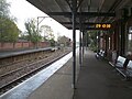
 Frinton Station - geograph.org.uk - 5337314.jpg 2,304 × 1,728; 997 KB
-
 Frinton Station car park - geograph.org.uk - 5343163.jpg 2,258 × 1,664; 1,007 KB
-
 Frinton War Memorial Club car park - geograph.org.uk - 5337304.jpg 2,304 × 1,728; 1.15 MB
-
 Frinton-on-Sea beachfront - geograph.org.uk - 4422432.jpg 3,888 × 5,184; 4.87 MB
-
 Frinton-on-Sea Golf Club - geograph.org.uk - 5369024.jpg 640 × 480; 57 KB
-
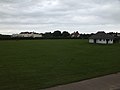 Frinton-on-Sea Golf Club and public open space - geograph.org.uk - 4060244.jpg 1,536 × 1,152; 752 KB
-
 Frinton-on-Sea Post Office - geograph.org.uk - 5377783.jpg 2,592 × 1,944; 1.28 MB
-
 Frinton-on-Sea railway station - geograph.org.uk - 5369010.jpg 640 × 480; 79 KB


,_Kirby_Cross_-_geograph.org.uk_-_5368883.jpg)


_-_geograph.org.uk_-_5368842.jpg)


.jpg)


_-_geograph.org.uk_-_4025125.jpg)
_-_geograph.org.uk_-_4025134.jpg)


,_Kirby_Cross_-_geograph.org.uk_-_5368960.jpg)


